
Journal
Best Walking and Biking Routes to Explore Pittsburgh's East End
Pittsburgh’s steep hills scare off a lot of new riders, but the East End is a different story. Here, bike lanes and quiet side streets connect most of the neighborhood, so getting around on two wheels feels far less intimidating.

Where Can You Walk and Bike Near East End?
The best Pittsburgh bike trails near the East End are the Highland Park Reservoir loop, Frick Park’s wooded trails, the Eliza Furnace Trail and the Three Rivers Heritage Trail. From Centre Ave, you can reach them using the Negley Ave and Penn Circle bike lanes, plus calm Neighborway side streets like Ellsworth Ave and Reynolds St.
Key takeaways
- The block at 5819 Centre Ave scores 95 for both biking and walking, and East Liberty ranks 3rd among Pittsburgh’s most bikeable neighborhoods.
- Bike lanes on Negley Ave, Penn Circle and S Aiken Ave all start within a few blocks of Centre Ave, and Penn Circle alone has more than 8,000 feet of protected lanes.
- Neighborways such as Ellsworth Ave, Reynolds St and Euclid Ave are the calmest bike routes, with a 25 mph limit and fewer than 3,000 cars a day.
- Highland Park’s flat 0.8-mile reservoir loop, Frick Park’s 15 miles of singletrack and the 26.6-mile Three Rivers Heritage Trail are all within riding distance.
- POGOH bike share costs $1 to unlock plus $0.19 a minute, and BikePGH’s official map shows the Neighborways that Google and Apple Maps leave out.
The East End Is One of the Easiest Places to Bike in Pittsburgh
Pittsburgh’s steep hills scare off a lot of new riders, but the East End is a different story. Here, bike lanes and quiet side streets connect most of the neighborhood, so getting around on two wheels feels far less intimidating.
The numbers back it up. The block at 5819 Centre Ave has a Bike Score of 95 and a Walk Score of 95. East Liberty ranks as the 3rd most bikeable neighborhood in the city.
This guide covers the bike lanes, side streets and Pittsburgh bike trails you can reach from Centre Ave, plus how to walk the area safely.
What Are the Best Pittsburgh Bike Trails Near the East End?
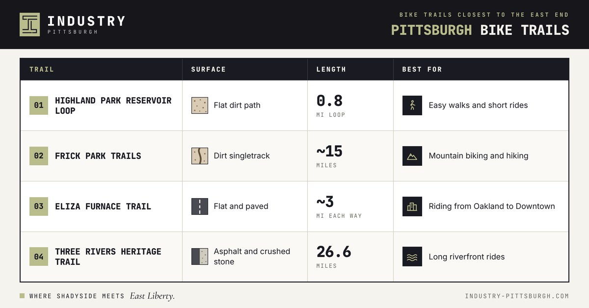
The best Pittsburgh bike trails near the East End are the Highland Park Reservoir loop, Frick Park's wooded trails, the Eliza Furnace Trail from Oakland to Downtown, and the Three Rivers Heritage Trail. You can reach all four from Centre Ave using bike lanes and quiet side streets.
Here are the bike trails in Pittsburgh, PA, closest to the East End:
3 Best Bike Lanes That Start Near Centre Ave
The East End has some of the best bike paths in Pittsburgh. Three of them start within a few blocks of Centre Ave.
Negley Avenue Runs North Toward Highland Park
Negley Ave has painted bike lanes from Centre Ave north to Stanton Ave. Shared-lane markings continue south into Shadyside. It is your most direct bike route north toward Highland Park.
Penn Circle Has 1.5 Miles of Protected Lanes
In August 2024, the city finished turning Penn Circle in East Liberty into a two-way street. The project added more than 8,000 feet of protected bike lanes, about 1.5 miles, plus 34 new crosswalks.
Flex posts, parked cars or paint separate riders from traffic, depending on the block. The lanes connect to the bike lanes on Negley Ave, Centre Ave and East Liberty Blvd.
South Aiken Avenue Links Shadyside to Bloomfield
Painted bike lanes on S Aiken Ave connect Ellsworth Ave in Shadyside with the Liberty Ave bike lanes in Bloomfield. Use this route to reach Bloomfield and Lawrenceville without riding busy Baum Blvd.
Neighborways Are the Calmest Bike Routes in Pittsburgh
Neighborways are quiet side streets that the city marks as bike routes. To qualify, a street must have a 25 mph speed limit and carry no more than 3,000 cars a day. Many add mini roundabouts, speed humps and curb bumpouts to slow drivers down.
East End Neighborways include:
Ellsworth Ave through Shadyside
Reynolds St from Mellon Park to Frick Park
Euclid Ave in Highland Park
Coral St and Comrie Way between Bloomfield and Friendship
If you ride to Oakland, our guide to commuting from Shadyside to Pitt, CMU and UPMC covers the best route.
3 Worth the Ride Pittsburgh Bike Trails From the East End
Highland Park Reservoir Is an Easy Flat Loop
The path around the Highland Park Reservoir is 0.8 miles long and almost completely flat, with about 21 feet of climbing. It suits a morning walk, a run or a first ride on a new bike. The main trailhead is on Reservoir Dr.
Frick Park Has 644 Acres of Wooded Trails
Frick Park is the largest city park in Pittsburgh, with about 15 miles of dirt singletrack. Riders share many trails with hikers and dogs, so slow down on blind turns. Some paths get muddy after rain.
To get there, take the Reynolds St Neighborway east from Mellon Park.
The Riverfront Trails Are the Flattest Long Rides
For long, flat rides, head to the rivers. The Eliza Furnace Trail is paved and runs about 3 miles from the edge of Schenley Park in Oakland to Downtown.
It links to the Three Rivers Heritage Trail, which covers 26.6 miles along Pittsburgh's rivers. You can also join the Heritage Trail in Lawrenceville, near 43rd Street.
Walking the East End Safely
With a Walk Score of 95, most errands near Centre Ave can be done on foot.
At Negley Ave and Centre Ave, the signal has an All Walk phase. All cars stop, and you can cross in any direction, including diagonally.
Centre Ave and Baum Blvd get busy at rush hour. For a calmer walk or ride, use Ellsworth Ave.
Streets are getting safer. In 2024, Pittsburgh had fewer than 3,000 crashes, 32% below the 20-year average. Still, 21 people died. “Every life lost to traffic violence is one too many,” said Mayor Ed Gainey.
How to Get a Bike and a Pittsburgh Bike Trail Map
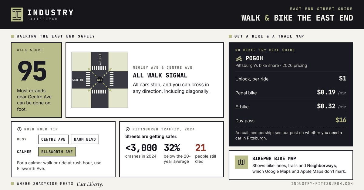
No bike? POGOH, the city's bike share, lets you try Pittsburgh biking before you buy. Under its 2026 pricing, a single ride costs $1 to unlock plus $0.19 a minute on a pedal bike or $0.32 a minute on an e-bike. A day pass costs $16. Our post on whether you need a car in Pittsburgh covers the annual membership.
For maps, use BikePGH's official Pittsburgh bike map. It shows bike lanes, trails and Neighborways. Google Maps and Apple Maps don't mark Neighborways.
Live Where Pittsburgh's Bike Routes Start
Bike lanes, Neighborways and Pittsburgh bike trails all start within a short ride of Centre Ave. That is a big reason East Liberty wins on two wheels when you compare it with Shadyside.
Industry Pittsburgh sits at 5819 Centre Ave, with secure bike storage for residents. Book a private tour and ride the routes for yourself.
Frequently asked questions
Is Pittsburgh a good city for biking?
Yes. Biking in Pittsburgh is easiest in the East End. Friendship, East Liberty, Bloomfield and Shadyside all rank in the city's top 5 neighborhoods for Bike Score.
Where can I find a Pittsburgh bike trail map?
BikePGH publishes the official Pittsburgh bike map. It shows bike lanes, trails and Neighborways.
Are there flat bike trails in Pittsburgh?
Yes. The Eliza Furnace Trail and the Three Rivers Heritage Trail follow the rivers and stay mostly flat. The Highland Park Reservoir loop is flat too.
Can you bike from East Liberty or Shadyside to Oakland?
Yes. Many riders take Ellsworth Ave to Neville St, then Bayard St into campus. This route skips busy Fifth Ave.
How much does POGOH bike share cost?
A single ride costs $1 to unlock plus $0.19 a minute on a pedal bike or $0.32 a minute on an e-bike. A day pass costs $16, and an annual membership costs $150.
Which Pittsburgh bike trail is best for long rides?
The Three Rivers Heritage Trail. It covers 26.6 miles along the city's rivers and connects to the Great Allegheny Passage, a long-distance trail that heads southeast out of Pittsburgh.
Keep reading
Shadyside vs. East Liberty: Which Pittsburgh Neighborhood Fits Your Lifestyle?
Pick Shadyside if you want leafy streets, boutiques, and the most walkable everyday life. Pick East Liberty if you want newer buildings, big errands close by, a bike-friendly hub and, often, a lower rent for a one-bedroom. Comparing Pittsburgh neighborhoods for the first time? This side-by-side guide gives you the numbers, lifestyle, and overall feel of each Pittsburgh neighborhood to help you decide which one fits you best.
Read the story →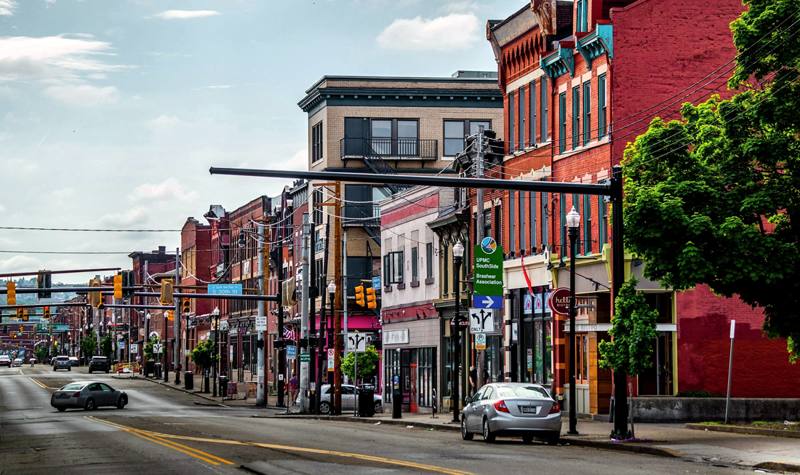
Commuting from Shadyside: Times to Pitt, CMU, UPMC, Oakland, and Bakery Square
How far is Shadyside from Pitt? See commute times to Pitt, CMU, UPMC, Oakland, and Bakery Square by car, bus, shuttle, and bike, plus the 2026 changes that affect your ride.
Read the story →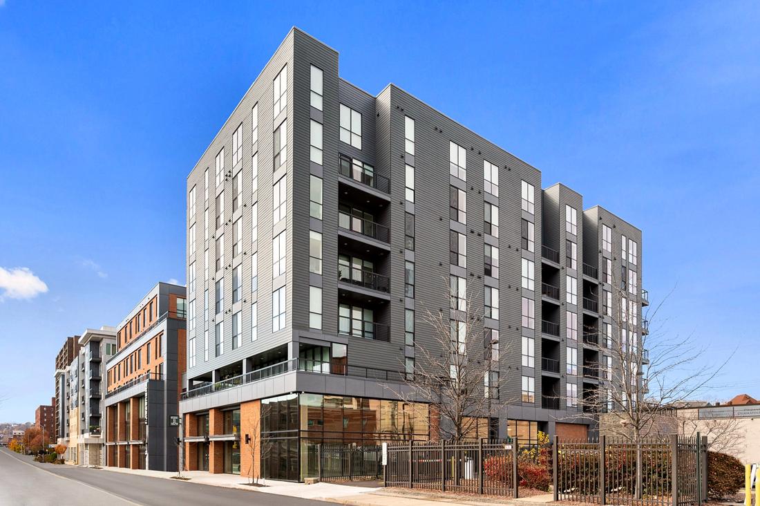
Do You Need a Car in Pittsburgh? Parking Permits, and PRT
if you live in Shadyside or East Liberty, you probably don't need a car for everyday life. You can walk to groceries, coffee and dinner. Buses and the East Busway will get you to Oakland and Downtown.
Read the story →